Client
Nextracker
Industry
About the project
Our client, Nextracker, is the world leader in smart solar tracking systems which significantly boost the efficiency of solar energy collection.
HTEC is currently building a mobile app that enables Nextracker’s field workers to wirelessly configure solar trackers at a utility-scale and monitor their parameters in the field for safe and efficient setup and operation.
Challenge
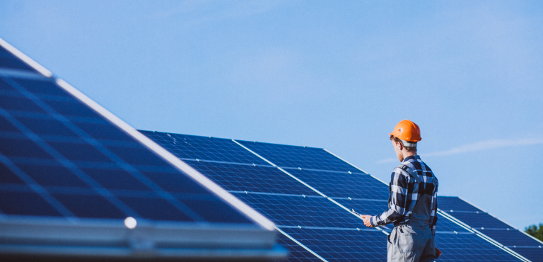
NX Horizon™ trackers that our client produces are robust constructions designed for the use in large solar power fields to orient a payload toward the sun to maximize the efficiency of solar energy collection.
Nextracker is unique in that they use drones to scan the terrain and a special algorithm for calculating the optimal placement of trackers on the terrain so that no solar panel ever gets shaded by another tracker row. HTEC was initially hired to create this algorithm.
The bigger challenge, however, presented itself along the way. Our client wanted to improve the operational efficiency of their field workers (commissioners) whose job was to configure the trackers so that the system can function in a predicted way.
Due to the use of an outdated desktop application in the configuration of solar trackers, these workers must walk from one tracker to the other carrying their laptops for miles in the scorching sun. In order to monitor and configure the parameters on each tracker, they have to connect their laptop to the device via a cable and wait for the data to be read before they can put the site in use. Besides being a tedious task, this part of the process is actually unnecessary making it a waste of time.
Solution
HTEC is committed to help Nextracker simplify this process and enable wireless tracker control over a mobile phone application which connects with solar unit controller devices over Bluetooth and Wi-Fi.
The application will allow field workers and engineers to wirelessly check parameters and track solar units on interactive maps, zoom in on each unit and read the data coming from it super-fast and easy.
Currently it is being tested by the commissioners on the field and great feedback is already pouring in as the solution we’ve built truly makes their work easier, faster, and more efficient.

The mobile application we’ve designed and built uses Wi-Fi and Bluetooth connectivity to collect and display the important parameters from solar trackers in an intuitive user interface and show each tracker on interactive maps for better navigation and data collection.
Success
By using the app, commissioners will soon be able to see themselves on the interactive map, locate the tracker they are testing, load the tracker’s parameters automatically into the app and configure them on the go on their mobile devices. During the testing phase the application has already shown an outstanding increase in the efficiency of field workers and their satisfaction with the job which they can now do faster and with less effort.